How can we explore the Russian Arctic Shelf?
David Bamford – david@windwardexploration.com
Western oil & gas technical journals as well as ordinary newspapers wax lyrical over the hydrocarbon resources of the Arctic, typically referring to it as the next global frontier. Huge resource estimates are bandied about – the USGS has suggested as much as 400 billion barrels oil equivalent remains to be discovered, with over 80% of that thought to lie in offshore fields.
Of course, onshore Arctic exploration has a significant history, notably in Alaska and West Siberia, and there has been intermittent exploration in the Barents, southern Kara, Chukchi and Beaufort Seas (Figure 1).
Nevertheless, a significant part of the Arctic is represented by the largest shelf on Earth, the Eurasian epicontinental shelf, of which the major portion, amounting to some 3.5 million sq kms, is located in the Russian Arctic. As a calibration, this is an area roughly equivalent to 700 offshore Angola deepwater blocks or 152,000 Gulf of Mexico deepwater blocks!
The area – Figure 1 – is, to a large extent, sparsely explored due to its harsh environment, high cost of operations and forbidding logistics.
From the efforts of Soviet scientists and their successors, we know that the Eastern Barents, Kara, Laptev, East Siberian and Chukchi Seas contain over 40 sedimentary basins, and we have a reasonable idea as to their stratigraphy, sedimentology and structural geology.
The Russian Barents and the southern Kara Seas represent the most explored petroleum provinces with large proven resources. In contrast, the North Kara is virtually unexplored, and there is only sparse seismic data over the other areas. Drachev, Malyshev & Nikishin (2010) give an excellent overview of the Tectonic History and Petroleum Geology of the Russian Arctic Shelves, and I have no intention of repeating what they say here.
However, building on the current knowledge of the petroleum geology, let us put politics to one side for the moment and assume that western IOCs will participate in exploration of the Russian Arctic Shelves. The question then arises – how do they help such exploration to proceed both efficiently and effectively, in the best interest of both license holders and the Russian government?
Three sub-questions follow:
1. How to prioritise the aforementioned 40 plus sedimentary basins?
2. There is a prejudice that these basins may be dominated by gas due to the provenance of the organic material in the source rocks? Can we figure out in advance of drilling which ones are ‘oily’?
3. IOCs have got used to exploring with vast amounts of ‘exploration’ 3D seismic. For example, the 40-50,000 sq kms of deepwater and ultra-deep water Angola are covered ‘wall-to-wall’ with such 3D, enabling Total, BP and others to enjoy a success rate of >90% in Blocks 15, 17, 18, 31 and 32. This 3D typically costs around $3000 per sq km. Is it even remotely possible to envisage huge swathes of Arctic ‘exploration’ 3D at this price?
In this article, I want to focus on the final point.
Broadly speaking, the Arctic presents two related problems to seismic acquisition – the ice itself and the limited time when the ice is open.
Two companies have stated that they are addressing this issue:
ION Geophysical have been working in the Beaufort and Chuckhi Seas, developing methods that work in and under the ice. They have shot very long offset seismic under the ice, this necessitating a very stable acquisition platform with no surface features, no gun floats or tail buoys. This, together with the fact that an ice breaker sails the line ahead of the seismic boat, clearing its path, sets up very complex noise patterns. To remove this noise, completely new algorithms have been built to be included in the processing system. In addition, within ION there are scientists who specialise in forecasting Arctic ice conditions, and also others who create ideal survey designs for these extreme conditions.
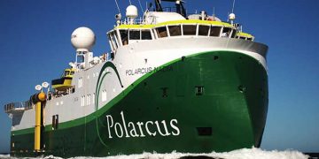
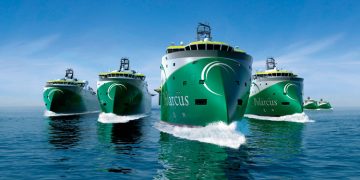
Polarcus have focussed on building survey vessels with the capability to operate in Arctic sea ice, meeting extremely demanding ICE classification systems that specify hull construction, propulsion requirements, winterisation systems etc. Also they are paying great attention to environmental issues such as sound mitigation and mitigation of fluid emissions. The company will launch a fleet of six such advanced seismic vessels.
Now these are great technology ideas, great innovations, but with the best will in the world I cannot see either of these two companies shooting vast tranches of ‘exploration’ 3D at a cost of $3000 per sq km – five or ten times that, perhaps?
My point is that this changes – displaces – what has been the basis for efficient and effective offshore exploration since the mid 1990’s and makes me wonder whether Arctic exploration can in fact be undertaken at reasonable cost? If we go back to exploring with 2D seismic, then we face drilling $100m plus wells at a risk of 1 in 4 or worse – not what we want to do!
What data and knowledge do we have at the moment? For most of the basins, there is a reasonable understanding of stratigraphy, sedimentology and structural geology; long wavelength gravity and magnetic data is available; as is a certain amount of 2D refraction and reflection data, the latter of which can be supplemented to some extent.
Perhaps the next stage of geophysics should be to fly extensive Full Tensor Gravity (gravity gradiometry) surveys which experience onshore, for example in East Africa, has shown can be a reliable tool for defining significant leads in a basin. ArkEx and Bell Geospace offer this service, amongst others. Integrated with existing knowledge, this approach is capable of producing a basin-by-basin lead inventory.
The next step in the exploration process would then be to shoot ‘postage stamp’ 3Ds over the most interesting leads, to mature them into prospects, using for example the approaches advocated by ION Geophysical and/or Polarcus: drilling could then follow.
I hope I don’t make this sound too simple? This is an extensive and detailed project which is beyond any one company and needs to be commissioned by the Russian government prior to licensing rounds.
Reference
Drachev, Malyshev & Nikishin, 2010 : Tectonic history and petroleum geology of the Russian Arctic Shelves: an overview, in Petroleum Geology: From Mature Basins to New Frontiers, published by the Geological Society, London.


