Transformative Subsurface Technologies
David Bamford, Finding Petroleum
‘Disruptive’ Technologies
I was struck by reading a commentary on Steve Jobs as CEO of Apple to the effect that he invented new things – the iPod, the iPhone, the iPad – before any of us realised we needed them. This seems to me to be a really good definition of innovation, of leadership in innovation, and it set me wondering where this exists in our industry?
Let me start off by referencing a couple of surveys that may, or may not, help:
Firstly, I noticed an interesting article on RigZone(1) some time ago talking about companies that are consistently innovative, the outcome of a study by three business school professors who studied the world’s most innovative companies for the previous 8 years.
Five skills of ‘disruptive innovators’ were identified by this effort, namely:
» Questioning allows innovators to challenge the status quo and consider new possibilties.
» Observing helps innovators detect small details – in the activities of customers, suppliers and other companies – that suggest new ways of doing things.
» Networking permits innovators to gain radically different perspectives from individuals with diverse backgrounds.
» Experimenting prompts innovators to relentlessly try out new experiences, take things apart and test new ideas.
» Associated thinking – drawing connections among questions, problems or ideas from unrelated fields – is triggered by questioning, observing, networking and experimenting and is the catalyst for creative ideas.
Really interesting I thought and similar in a way to some of the ideas of Niall Ferguson on why ‘the West’ rose to pre-eminence in the 19th and 20th Centuries and George Magnus’s on why China (and other community rather than individually oriented countries) will struggle to outpace the West in the long run.
Great stuff!
But then, IMHO, the whole article was undone by referring to a study by HOLT, a subsidiary of Credit Suisse, to identify the leading 100 innovative companies, based on how much revenue companies claimed new offerings would yield out into the future. In this top 100, from the oil & gas sector, they put forward FMC-Technologies, Schlumberger, China Oilfield Services, Cameron International, Tenaris SA and Halliburton.
Now I wonder if you asked managers in the oil & gas sector to name their top 5 innovative companies – the ‘disruptive innovators’ – whether any of these 6 would figure?
Well, via a slightly circuitous route, and the second survey I want to remind you of, we have access to some insights on this. Every year Barclays Capital publishes a survey of the world oil & gas industry and include a review of technologies, based on what their respondents said. The most important technologies by year are pretty consistent with horizontal wells, 3D seismic and completions technology being rated the top three. The current perception that horizontal wells and hydraulic ‘fracking’ are now the two most important technologies is clearly based on the success of shale gas E&P in the USA; they have become ‘routine’.
As a third piece of data, I offer the insight from Shell and McKinsey amongst others that the oil & gas industry is one of the most conservative industries around.
Two of the top 3 aforementioned ‘most important technologies’ – horizontal drilling and 3D/4D seismic – are great examples of the decades it takes for new ideas to achieve market dominance in our industry, having been first used in the 1940’s and 1960’s respectively!
None of the above seems consistent with the notion of ‘disruptive innovators’ which to me carries an underlying message of being willing to take risks.
So I thought I would reprise my views on those ‘disruptive’ technologies that have the potential to transform our industry…
Full Tensor Gravity Gradiometry
One of the more important breakthroughs of the last few years has been the emergance of airborne gravity via Full Tensor Gravity Gradiometry (FTG). Put simply, two extremely sensitive gravimeters, one above the other, record all 9 tensor components of the earth’s gravitational field. In comparison with conventional gravimetry, the twin gravimeters allow much of the ‘in-flight’ noise to be removed and this ‘full tensor’ approach allows the source of anomalies to be located relatively precisely in the 3D sub-surface.
Thus reasonably precise, reconnaissance phase, 3D images of the sub-surface can be generated and FTG becomes an especially powerful tool when integrated with other geophysical technologies, for example with modest amounts of 2D seismic or perhaps magnetics (especially when ‘depth to basement’ – the depth to the base of the sedimentary pile – is a key deliverable). Obviously this can be used anywhere as a relatively inexpensive early stage exploration tool but it should prove particularly useful in remote or hostile onshore areas; the jungles of Gabon and the Congo would be an example.(2)
Onshore Seismic
Seismic technology remains the main, some would say the only, means of interrogating the sub-surface in sufficient detail to allow insightful geological prediction and the precise location of wells.
So I am going to state quite baldly that onshore exploration technology is miles behind offshore.
Why is this??
The availability of regional or ‘exploration’ 3D has been the main driver of exploration success offshore and especially in Deep Water. Huge swathes of multi-client 3D, covering for example whole 5000 sq kms blocks offshore Angola, are available at prices as low as $3000/sq km, are turned around exceedingly rapidly, and are interpreted at great speed.
The technology drivers have been: highly efficient and effective acquisition systems based on vessels capable of towing many, many streamers and multiple guns; simultaneous processing – to some extent on-board – but nowadays mainly via satellite transmission; powerful interpretation workstations, capable of dealing with these vast surveys and delivering both time and attribute-based interpretations.
As an ‘old codger’ I would simply point out that this is an incredible transformation from the days of ‘postage stamp’ surveys in the North Sea that took two years to go from design to delivery of a ‘final’ product…and then interpretation on paper invariably meant that only 1 line in 10 or maybe 5 was fully interpreted!
What is more, very complex geological problems, for example at great depth or beneath salt or basalt, can now be tackled, for example by multi-azimuth, wide-azimuth, wide-angle recording.
Thus, modern 3D lies at the heart of modern offshore exploration, integrating stratigraphy, sedimentology, facies prediction, rock physics, hydrocarbon phase prediction on the regional and prospect scales, and then providing a ‘surgical’ tool for choosing exploration well locations.
It is a fact that such integration is much rarer onshore; 3D seismic plays a much lesser role.
Here’s an example I heard about a while ago, namely exploration in the Llanos foreland of Colombia where ‘everybody now explores with 3D seismic’, leading to success rates as high as 75% – pretty remarkable in an onshore environment. The terrain is this area is moderately undulating ‘cow country’ so relatively straightforward for acquiring 3D…..and yet the cost per sq km is roughly an order of magnitude, ten times, that of offshore multi-client 3D…so we are talking $25-30,000 per sq km.
Step back into the Llanos fold belt itself, and the cost is more like $100,000 per sq km.
Why so? Why these differences? How can we pay so much!
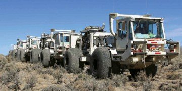
My contention is that onshore seismic has simply not yet seen the acquisition technology breakthrough that transformed offshore 3D over 15 years ago. As my old friend Ian Jack has pointed out many times, supported by Bob Heath of iSeis, both at Finding Petroleum events(3), one key is the slow pace and man-power intensive nature of using cables, and that the first breakthrough we seek is the advent of light-weight, long-life, wireless systems.
What this means is that, in turn, outside North America, onshore exploration itself remains untransformed, with the exception of the odd example such as that I have quoted from Colombia, Tullow Oil’s activities in East Africa, one or two others.
I am fully aware that it would be unreasonable to expect onshore 3D seismic prices to drop to the level of offshore multi-client data, largely because onshore seismic crews have to contend with a variety of terrains and topographies, and that significant numbers of people will inevitably be involved in deploying onshore seismic equipment.
A better message than a simplistic ‘cheaper please!’ is that the cost of onshore 3D needs to be at the point where shooting it extensively – so it can be used for regional and prospect work – fits neatly into an approach of ‘gradually focussing your onshore exploration’.
Permanent Reservoir Monitoring
Observations of both deep (oil & gas) and shallow (ground water) reservoirs lead to the conclusion that time-lapse geophysics – any observations of any producing reservoirs over time – must be based on the understanding of the physics of fluid-filled, parallel, compliant, fractures/micro-cracks – dilating or compacting as the reservoir is produced. This physics, this New Geophysics, has been documented over many years by Crampin, based especially on understanding and observing the effects of closely-spaced stress-aligned fluid-saturated microcracks on seismic shear-wave splitting (SWS) in the crust and upper mantle. Whereas P waves are in both theory and observation only weakly sensitive to such crack systems, SWS is wholly determined by parallel microcracks and can be measured with first-order accuracy. Thus SWS is a second-order quantity (small changes in shear-wave velocities) that can be read with first-order accuracy – bringing tremendous resolution.
To Summarise:
P-wave reflectivity – the basis of all our conventional reflection seismic technology, whether 2D, 3D or 4D – is not sensitive to rock anisotropy.
P-wave velocity anisotropy and, most significantly, shear-wave splitting are, proffering a methodology for the new geophysical characterisation of real rocks.
The case for Permanent Reservoir Monitoring
The notion that reservoirs, having experienced a maximum horizontal stress over geological time scales, will contain aligned micro-cracks and at a critical density – thus responding rapidly to quite small pressure changes induced by injection and production – has significant implications for geophysical, especially seismic, monitoring of reservoir dynamics.
First of all, we can say that conventional 4D seismics – towed streamer surveys for example – only discern changes in P-wave reflectivity and thus offer at best an incomplete view of reservoir dynamics, one that is unquantifiable, allowing only empirical or ‘phenomenological’ comparisons.
Secondly, a complete, predictive, quantifiable, view of reservoir dynamics requires 3C seismic acquisition, with probable reservoir volatility strengthening the case for frequent measurement i.e. permanent installations.
Finally, changes in stress can be monitored by changes in SWS so that stress-accumulation before fractures in reservoirs (and earthquakes and volcanic eruptions) can stress-forecast the time, magnitude, and estimate location of impending fractures (and earthquakes and eruptions). This is of course relevant to the practice of ‘fracking’ and associated seismic activity.
Conclusion
In reality, the technologies I have described are all things we know how to do.
Given this, we must ask why the major oil field service companies do not provide these technologies. It cannot be that they are unaware of them but they do seem to prefer to offer what I have termed ‘incrementalism’ of their staple products. Perhaps they are happy to leave the innovative regime to smaller players who they hope to control and/or oppose? And perhaps, if these smaller players succeed in ‘disrupting’ the existing market place, then as a last resort – or even as a clear strategy – they can be taken over?
References:
(1) www.rigzone.com/news/article_pf.asp?a_id=109850
(2) www.findingpetroleum.com/n/Insight_The_increasing_use_of_Gravity_Gradiometry_in_the_Exploration_Workflow/edb52e81.aspx
(3) http://64be6584f535e2968ea8-7b17ad3adbc87099ad3f7b89f2b60a7a.r38.cf2.rackcdn.com/Jack.2013.OilVoiceForum.March.Rev3.pdf
(4) http://www.geoexpro.com/article/Reservoir_Dynamics_and_the_New_Geophysics/61d1026e.aspx